
In Montgomery County, Maryland, just across the river from my hometown of Leesburg, Virginia, there are two massive structures both made out of quartzite; one was constructed by man and the other by nature. Can you guess what they are? Give up? Well, I will tell you in a minute. First let’s discuss what quartzite is.
Quartzite is a stone which comes from the metamorphosis of sandstone whose composition contains at least 80% quartz. The sandstone metamorphosizes into quartzite when subjected to heat and pressure. Its color is usually white to grey unless there is a presence of iron oxide which will turn it pink to red.
Because of quartzite’s hardness, it does not erode easily and makes a great building material.
The resistance to erosion is the reason we have our natural structure, Sugarloaf Mountain. This 1,283- foot mountain towers over the farmland in Montgomery County and even Loudoun County, across the river, where there is a road named Sugarloaf View Lane!
To geologists Sugarloaf Mountain is a monadnock, an isolated hill which sticks out of the surrounding level land. But to local residents it is a wonderful private park with beautiful hiking paths and even more beautiful views and a curious history. Listen to this lecture about Sugarloaf Mountain given by my friend Ralph Buglass a few years ago to the Poolesville Senior Center: https://www.youtube.com/watch?v=LhTi31gtRng.
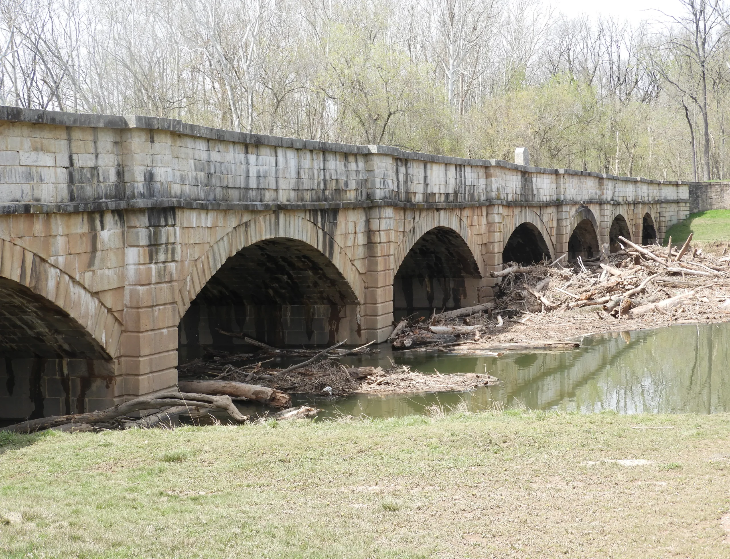
About four miles from Sugarloaf Mountain, where the Monocacy River flows into the mighty Potomac River you will find the beautiful Monocacy Aqueduct. This huge structure was built between 1829 and 1833. Its purpose was to carry the C&O Canal over the Monocacy River…and it too is constructed of quartzite.
When construction began, builders contracted with “Mrs. Nelson” to quarry stone (quartzite) from her property on the flanks of Sugarloaf Mountain. After two years of construction, it was discovered that Mrs. Nelson’s stone was too soft to withstand the pressure of the river water and it was decided to redo the work which had already been done, setting the project back years. (The specific location of Mrs. Nelson’s quarry was recently re-discovered by Poolesville historian Jon Wolz using Lidar projections and historical records.)
The builders decided to switch to a quarry on “Mr. Johnson’s” land, which proved satisfactory as demonstrated by the fact the Monocacy Aqueduct is still standing today. There were two quartzite quarries on Mr. Johnson’s land, one white and one red and both are accessible by foot and located in the Monocacy Natural Resource Management Area.
For more information on the construction of the Monocacy Aqueduct, read the delightful little book by Robert J. and Elizabeth Perry Kapsch titled, “Monocacy Aqueduct: On the Chesapeake and Ohio Canal.”
Also, check out Montgomery County historian Jon Wolz’s FaceBook page for regular displays of beautiful pictures of the C&O canal and surrounding countryside.
Finally, if this short essay on historical stone interests you, check out this web site for


Leave a Reply